  |
 |
|
|
|
|
|
|
|
|
||||||
| [ Home ] | [ Study Area ] | [ Forest Types ] | [ References ] | [ The Team ] | [ Contact ] | [ Links ] |
|
|
||||||
|
|
|
|
|
|
|
|
|
|
|
||||||
| [ Home ] | [ Study Area ] | [ Forest Types ] | [ References ] | [ The Team ] | [ Contact ] | [ Links ] |
|
|
||||||
|
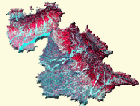
STUDY AREA : Jammu, the southwestern district of Jammu & Kashmir state lies in 320 27′ and 330 50′ N Latitude and to 740 19′ and 750 20′ E longitude, with an approximate geographical area of 2,942 sq km. The altitude varies from 320 m to 1,675 m above mean sea level. The low-level hill country outside Pirpanjal and between Jehlum and Ravi constitute Jammu Hills. The region lies among the tertiaries and contains two distinct geological formations, i.e. the Shiwaliks and the Alluvial Plains, as northwestern extension of Indo-Gangetic Plain. The Shiwalik system, comprising hills of moderate elevations, dips generally to the south and is of sedimentary character distinguishing the division of the system into |
|
|
a) Upper Shiwalik b) Middle Shiwalik c) Lower Shiwalik |
|
|
Geology : The upper and middle Shiwaliks of Jammu hills show a more or less close lithological analogy with those of the adjacent Salt range and Potwar areas. The lower division, however, exhibit marked variations which relate more nearly to the Murrees than to the typical Kamliyal or Chinji facies. The rocks exposed to north belong to Murree formation that comprises a distinct suite of red and purple shale-clay, grey-greenish sandstone-siltstone, lenticular-conglomerate etc. To the south of Shiwaliks are exposed quaternary sediments occupying the gently sloping to flat plain areas. The older alluvium, deposited to the south of Jammu formation, comprise fine to coarse grained sand, silt and clay. The newer alluvium is deposited between the distributaries of various rivers flowing in the plains and along smaller nallahs and khads. Barring such local variations, the Shiwalik system in particular and the tertiaries in general are developed in almost all along the foot of the Himalayas. Topography and Soils Physiographically, Jammu district is divided into three distinct zones. A) A) Jammu Foothills : Comprising low hills embracing features ranging from pine clad slopes near Nandani to practically bare, almost flat-topped hillocks in vicinity of Bantalab. Beset with gorges and ravines, the major part of this zone is under forests and offers but limited facility to agriculture. The soils are well drained and have sandy loam to clay loam texture with normal pH reaction varying from 7.5 to 8.8. The nitrogen and phosphorus status is low and potassium high. B) The Kandi belt : In local terminology it includes small dry hillocks and gentle slopes, made up of boulder mass. This undulating tract, with Jammu proper situated in it, extends from Digiana to Purkhu on northern side of Jammu-Pathankote highway and stretches upwards to Nagrota. The area is criss-crossed through a number of criss-crossing shallow seasonal streams locally known as Khads with stony beds, active only during rains. The region supports dry and thorny vegetation in general. The soils are shallow and infested with gravel and stones. C) The level land : These Chenab-Ravi alluvial plains occupy more than half of the total geographical area of the district. This fertile stretch has smooth topography and comprises the major agricultural tract of area. The soil is high in potash and deficient in nitrogen and phosphorous. The texture is heavy clay with impeded drainage; pH ranges from 8.6 to 10, mostly saturated with sodium. Multiple cropping is a common practice. The region is well known for the quality Basmati rice in India. Climate Rainfall : The normal annual rainfall of Jammu is 1113 mm, 72% of it is received during monsoon months. Average number of rainy days to a year is 54. Temperature : Jammu experiences great extremes of temperature. June is recorded as hottest month with average maximum 390C. January is recorded the coldest month with average maximum temperature of 19.40C and average minimum 6.80C. The foggy winters and scorching summers bear a marked climatic perturbation. Relative humidity : It is least in May and highest in August with average recordings to the tune of 23% and 66.8% during afternoon, respectively. Drainage : i)Chenab river : Chenab river, the largest and mightiest of all rivers in the state finally leave the state in tehsil Akhnoor to Pakistan. River Chenab before entering Pakistan is joined by Munnawar Tawi at Hamirpur. Kanah Nallah in the middle part of Kalidhar range, and southern flank, crisscrossed by khads mainly Kuppi Khad, Narryah Khad, Tandewali Khad, Samawali Khad, Mawewali Khad, Thindewali Khad and Laccki Khad finally drain into Chenab river. Ranbir Singh Canal from river Chenab fulfils the irrigation demands of the southern flank for paddy cultivation. ii)Tawi river : Tawi river, flows through the middle of the district catering to all the domestic, livestock and agricultural needs of the hilly tract of Jindrah and Bahu-Mahamaya ranges. Jajhar Nallah and Gambhir Khad in the Jindrah range finally drain into River Tawi. Middle part of the Jammu range, namely Nagrota block is drained by some prominent khads like Tandewali Khad, Simbal Lahir Khad, Pungaliwali Khad, Chirua Nala, Balin Nallah, besides a large number of small rivulets, add to river Tawi. Suketer Nallah and Deod Nallah in Nandani block of eastern range are the main tributaries of river Tawi. Northern part of Bahu-Mahamaya range is drained by various khads and nallahs, prominent among them being Sardan Nallah, Surawali Khad, Bainwali Khad and Siddrayanwali Khad all finally add to river Tawi. South-western part of the range is drained mainly by Bhitindiwali Khad, Tutanwali Khad, Chhatawali Khad, Balwal Nallah and Bari Khad all joining river Tawi. iii)Munnawar Tawi : A small portion in the northern part of Kalidhar range is drained by Munnawar Tawi. iv)Devak river : The eastern and southeastern part of the range is drained by khads like Karnalwali Khad, Palaiwali Khad, Sangharwali Khad and Gori Khad which finally enter into Devak river. v)Basentar river : Along the north-eastern flank the region is mainly drained by river Basentar which is added by a large number of small khads. Uttarbahini joins river Basentar at Samba which finally drains into Pakistan. |
|
|
|
|
